Project Overview
BMA and RocketDNA have established one of Australia’s largest and most operationally mature autonomous drone deployments, combining scale, near-real-time data capture and advanced airspace integration across four major coal mine sites in Queensland. The program demonstrates how drone-in-a-box technology can move beyond trial activity and become part of the daily operating backbone for safety, production, survey and inspection workflows.
The Mission
Across four BMA sites in the Bowen Basin, RocketDNA operates a 16-drone fleet under CASA BVLOS approvals, flying about 1,500 missions per month. The deployment spans eight drone-in-a-box pad sand provides more than 80 km of range with minimal site infrastructure, enabling high-frequency operations across large and dynamic mining environments.
This matters because mine conditions can change constantly, while traditional inspection and survey workflows often depend on vehicle-based field checks, manual launch procedures and data layers that are updated less frequently. By shifting data capture to an on-demand autonomous network managed from a Remote Operations Centre, BMA gains faster access to current imagery and spatial information without first sending people into the pit.
.png)
Complex Airspace
The deployment runs in some of the most complex airspace associated with any mining operation in Australia. Certain missions are conducted within 1 nautical mile of a busy aerodrome near Moranbah, where the airport sees about 40 to 50 aircraft movements per day and services three commercial airlines.
To support this safely, RocketDNA works in close coordination with Qantas and other carriers under strict engagement and deconfliction procedures that allow on-demand drone operations alongside regular passenger traffic. Since those procedures commenced, the operation has deconflicted more than 400 flights involving aircraft taking off or landing at Moranbah Airport.
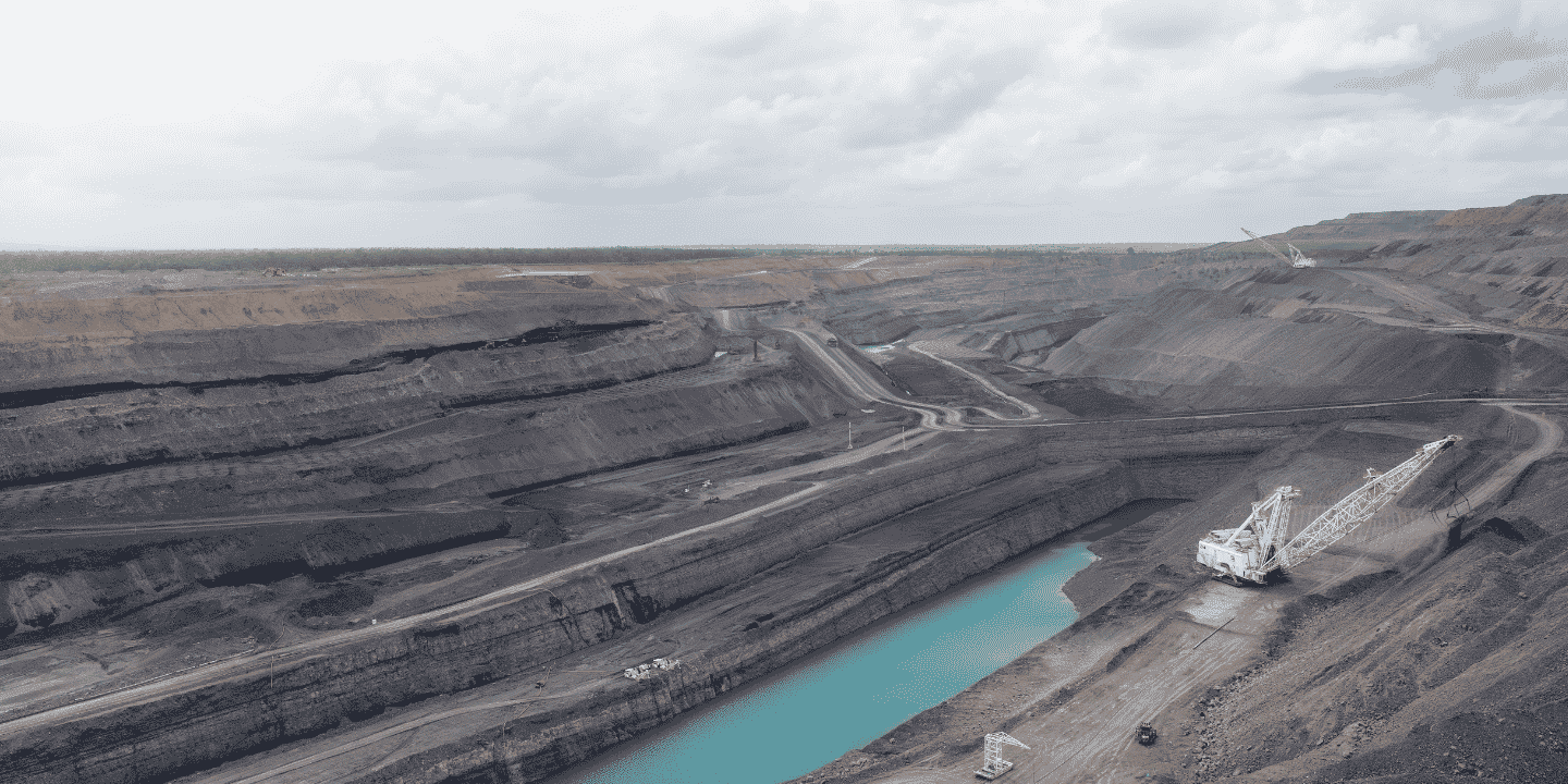
Operational Environment
Large open-cut mine sites are dynamic, dispersed and time-sensitive. At Caval Ridge, for example, the site stretches to roughly 16 km, making it time-consuming for supervisors, surveyors and technical teams to drive across the operation simply to confirm conditions, identify issues or prioritise where attention is needed most.
Historically, teams spent significant effort on routine field tasks such as launching drones from inside the pit, conducting repeated visual checks, placing survey pegs and supporting production with manual spatial capture. That approach consumed skilled labour, delayed access to current information and increased exposure to active mining areas, haul roads and other operational hazards.
.png)
The Solution
With RocketDNA’s xBot drone-in-a-box system, BMA teams request a mission through the Skylink platform, the drone launches from the box, captures imagery or survey data where it is needed, and uploads results to the SiteTube cloud platform, with usable outputs typically delivered within about 15 minutes of the request.
Because RocketDNA supplies data in formats that integrate directly into downstream workflows, the value is not limited to image capture alone. The system gives operational teams timely, usable information that can be absorbed into survey, planning, production and safety processes with less manual effort and less delay.
.png)
Practical Applications
The rollout began by supporting survey teams with faster access to spatial data, but it has quickly expanded into a broader operational capability across multiple functions. Current use cases described by BMA personnel include daily coal surveys, highwall mapping, water level surveys, geotechnical inspections, in-pit coal mining inspections, daily production imagery and rapid visual checks of changing pit conditions.
The system also supports better decision-making before people enter the field. Rather than driving across the site to work out what needs attention, teams can review recent aerial imagery from their computers, identify the areas that matter most and target their time accordingly.
Emergency response is another important application. BMA teams highlighted the value of live feeds and thermal imagery, including identifying hot tyres and other heat-related issues, which can improve situational awareness and help response teams act faster during critical events.
.png)
Safety and productivity outcomes
One of the clearest benefits is the reduction in unnecessary exposure. Personnel no longer need to routinely enter the pit to launch drones or perform some inspections that can now be completed remotely, which reduces vehicle movements and limits time spent in high-risk operating areas.
The productivity gain is equally significant. Surveyors and technical teams can spend less time on repetitive field collection and more time on higher-value analysis, planning and operational improvement, while production and safety teams receive more current information to support daily decisions. BMA personnel also noted that the technology has saved substantial time compared with older ways of working.
Why this deployment stands out
This case study is notable not only for its scale, but for the maturity of the operating model. BMA and RocketDNA have combined autonomous flight, remote operations, airspace coordination, downstream data integration and practical site adoption into a live production capability rather than a standalone innovation project.
In a mining environment where conditions shift constantly and operational decisions carry safety and productivity consequences, that combination is powerful. It gives teams a faster, safer and more repeatable way to understand what is happening across the site each day, while creating a strong foundation for broader digital, automation and AI-enabled workflows in the future.
Watch here for the full video explainer on this deployment:
Location

Contact RocketDNA Today
Interested in finding out more about how our drone data solutions can assist you with your data need?
Complete the contact form to get started and find out more.