Project Overview
At their Binduli operation in WA, Norton Gold Fields operates multiple open pits that feed a single central processing plant. With the plant running at capacity, any waste rock that makes it into the mill reduces overall gold recovery.
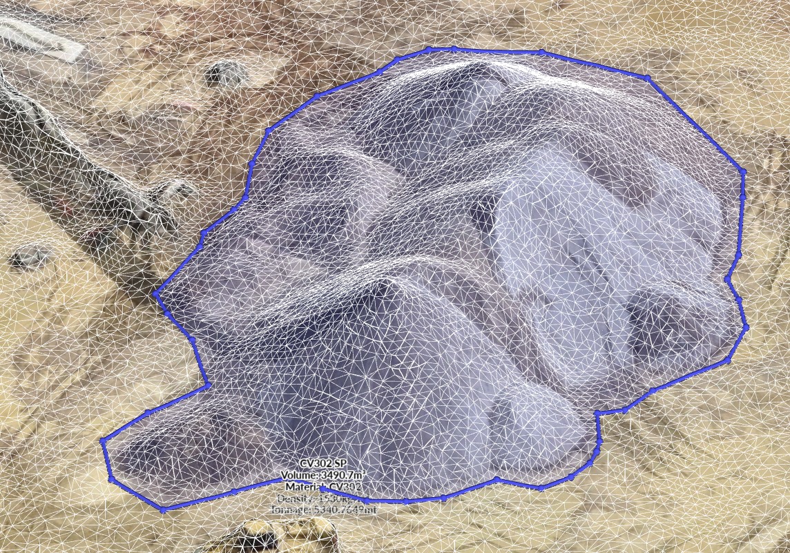
That’s why their Head of Geology wanted faster, more reliable blast-survey data. Accurate dig boundaries meant the difference between sending high-grade ore to the plant or the waste dump.
Previously, the survey team needed 3 to 4 hours after each blast to capture the data, process it, and deliver it. Meanwhile, the geology team would be waiting on that data to mark out ore and waste.
Today, Norton can capture post-blast data in under an hour, map the entire pit weekly, and use daily panoramas to speed up planning. At the same time, they can keep people out of the pit and strengthen grade control. Here’s how they did it:
Their goal: unlock the value of new geology software
Norton’s geology team had recently implemented block-modelling software designed to pinpoint high-grade zones in the post-blast muck pile. To get the most out of the software, they needed survey data delivered fast, in a consistent, ready-to-use format.
The vision was clear: move away from spray-paint boundaries and manual workflows, and instead feed digital terrain models (DTMs) directly into the geology tool. That meant finding a way to automate data capture and processing, so geologists could spend more time interpreting ore–waste boundaries and less time waiting on datasets.
Manual drone surveys were the first step forward. Surveyors could fly the pit after a blast, process the data, and deliver it to geology. But the turnaround was still 3–4 hours, so they couldn’t get all the benefits of the new software.
The opportunity was there. The company just needed a more efficient way to connect surveys with geology’s digital workflows.
Ever-increasing survey demands
It wasn’t just the geology team wanting faster aerial data. Demand for survey data was growing across the site: mine planning needed updated surfaces, operations wanted regular panoramas, and environmental teams required imagery. Norton’s surveyors were working hard but under pressure to keep pace, and adding more surveyors to ease the workload wasn’t necessarily viable. Skills shortages make it hard to find skilled, experienced people so recruitment is slow and expensive.
Researching their autonomous drone options
Norton’s mining systems team had researched different autonomous systems and reached out to us to discuss remote drones as a way to solve their post-blast challenges.
We recommended our xBot unit for the job as a number of other mines were already using them to do fast and detailed post-blast survey work.
Five years earlier, Norton had looked at autonomous drone systems but found them cost prohibitive. At the time, they were looking at $500,000 per unit which made the business case unattractive.
A strong business case
But now it turned out that the economics had shifted dramatically in their favour. When we showed them the real cost of an xBot system, they were surprised by how affordable it was.
The business case became quite straightforward. Their post-blast work could be captured in approximately 40 hours of automated flights per month and would replace at least 3-4 hours of manual survey work each time. Each autonomous unit was now priced at approximately $100,000, plus roughly $30,000 for site works, a fraction of the $500k they’d been quoted 5 years earlier.
To hire more surveyors (if they could find them) they were looking at $180k/year per person. And when they factored in the additional survey capacity combined with better grade control and safety benefits it was a no-brainer.
Implementation: fast installation with no red tape
Norton went ahead with an xBot trial in early 2023. The setup and installation only took two weeks: they did basic site works then our engineers installed the unit on a skid, integrated it with their systems, and trained their teams on how to use it.
Regulatory approvals can really slow things down. This wasn’t an issue for Norton because we managed all CASA licensing under our own operator certification. That’s how they could get everything running quickly while meeting all compliance and safety standards.
The key was a smooth integration. Norton didn't want another data source to manage. They needed drone data to flow directly into existing systems, so we built a simple workflow to fit their operations without adding new layers of complexity.
Results: post-blast data in 1 hour
The impact of the new autonomous drone system was clear almost immediately.
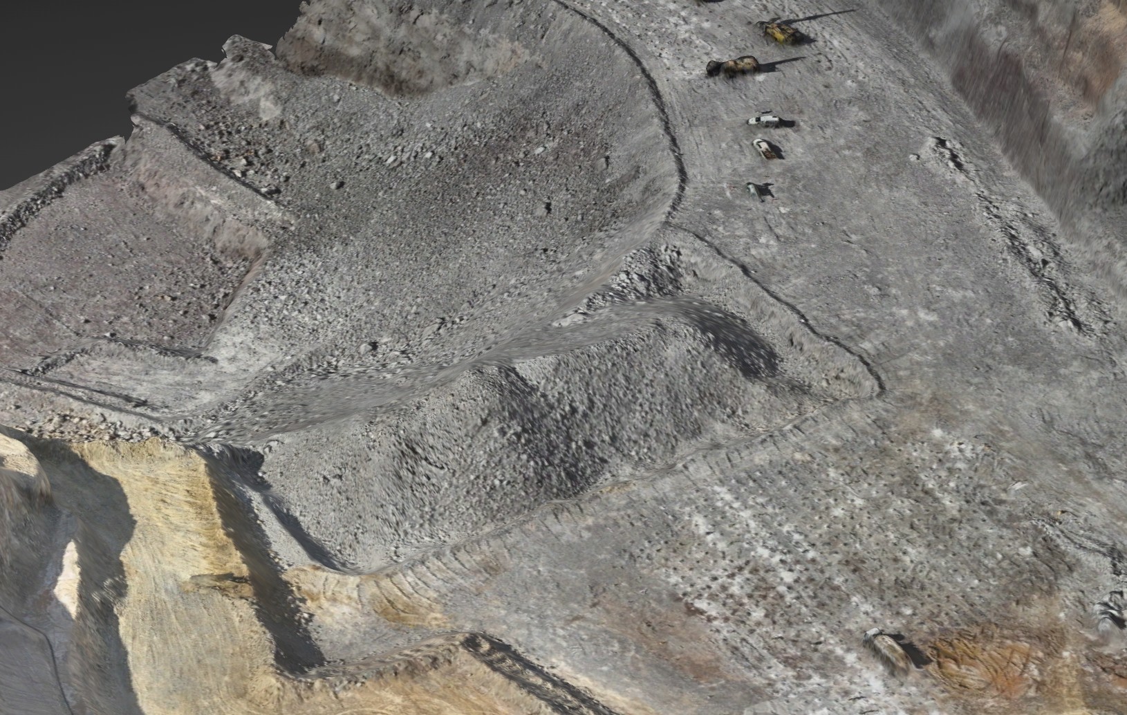
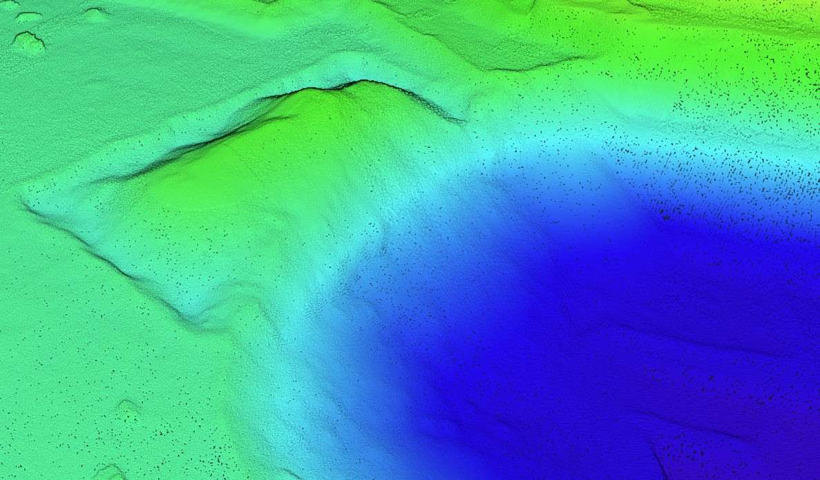
Post-blast data delivery dropped from 3-4 hours to 30-60 minutes. After the survey, the data is processed automatically and sent to excavator operators with dig areas digitally mapped out. No more manual marking out the pit which has reduced dilution and protected mill feed quality.
It has also eased the pressure on their stressed out survey team. By allocating more of their routine, repetitive work to autonomous drones they now have more time for geology support, complex measurements, and priority requests from other departments.
“Surveying has a shortage of qualified people. The ones who are qualified are $180,000 per year. We can’t get them. The drone helps us keep our heads above water,” explained one senior surveyor on site.
Finding new drone use-cases across their site
What started as simple post-blast survey flights quickly turned into multiple flights per week for other aerial surveys.
Norton’s team now uses the xBot to do a number of tasks. Scheduled flights capture the entire pit surface weekly, feeding current topography directly into Norton's planning software for production scheduling and pit design.
They also get a visual overview of the mine every morning. 360 degree panoramic flights give the incoming shift immediate updates on pit conditions and equipment positions.
The weekly pit maps and daily panoramas speed up planning, keep multiple teams aligned with current conditions, reduce miscommunication, and improve shift handovers.
Location

Contact RocketDNA Today
Interested in finding out more about how our drone data solutions can assist you with your data need?
Complete the contact form to get started and find out more.