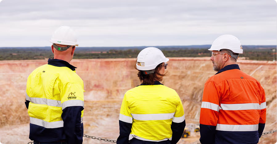
Get faster survey data without overloading your survey team
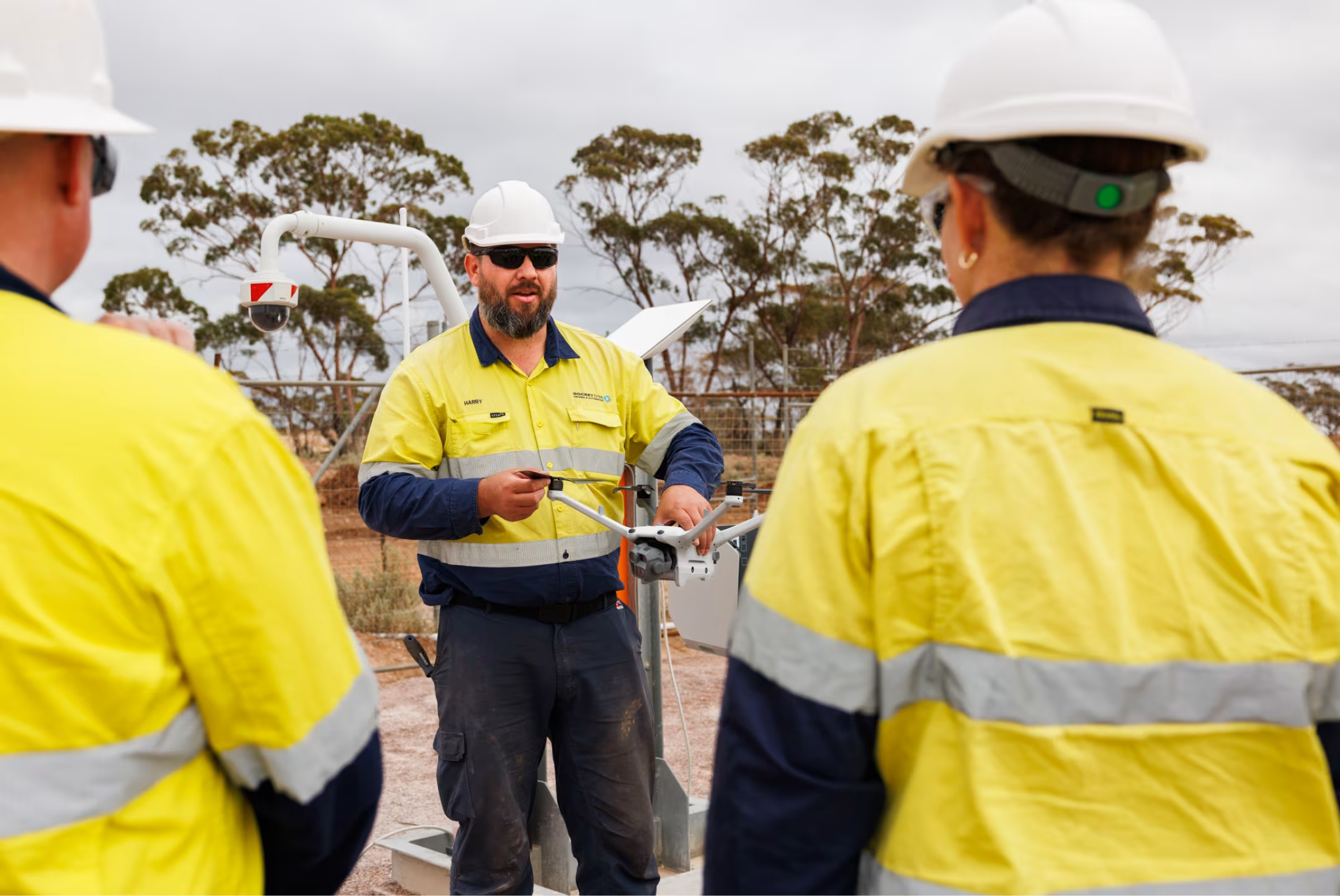
Automate routine drone surveys with the xBot autonomous drone system. We operate the drones remotely so you get site data and images when you need them.
The demand for survey data keeps growing at every mine
Manual drone workflows can’t keep up with the requests for current site imagery and faster information. With an xBot on site, anyone can schedule flights and get the data they need.

On-demand & scheduled flights
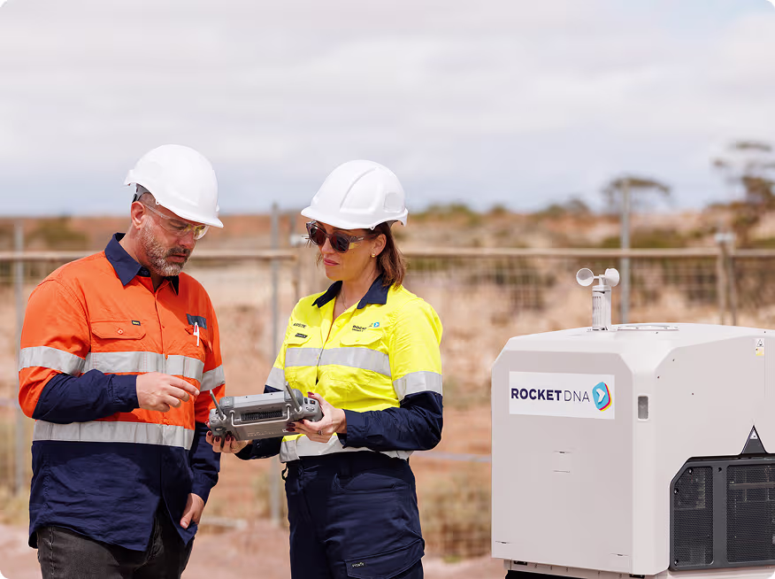
Schedule flights and see drone availability using our SkyLink software

Remote operations support
Our pilots fly your missions remotely whenever you need them, 24/7

Instant access to images & data
Your survey images are uploaded securely to the cloud for instant access and easy file sharing

Safe and compliant
We handle all of the CASA approvals and compliance for you for safe operations
Give your survey team time back
Routine flights and repeated data collection take hours out of surveyors’ days. Visits to remote or hazardous locations add risk and slow surveys further.
xBot automates these repetitive survey missions so surveyors spend less time driving around and less time in the pit. With a drone-in-a-box on site, surveyors are freed up to do higher-value work while routine data capture runs in the background.
Get survey data and imagery on-demand
Operations teams need to know exactly what’s happening in the field but manual drone operations can delay access to the data they need.
With an xBot on site, you can get survey data on demand. Teams can get the information they need faster, to keep drill and blast cycles moving, monitor pit conditions safely, and have more productive pre-shift meetings.
Make drone imagery available to anyone on site
When mining teams need survey images and data quickly, waiting for manual flights and data processing isn’t ideal.
xBot makes drone imagery available across site whenever it’s needed. Anyone can request a flight through our central portal and get their data fast. Less driving around, less people in the pit, and faster access to the information they need.
Simple and fast to deploy anywhere
Scaling your drone survey capacity across multiple sites can be slow and complicated. Regulatory approvals, IT requirements, and logistics can hold back new projects or urgent inspections.
Our drone-in-a-box systems are designed for rapid deployment. Sites can be operational in days rather than months, with minimal infrastructure and no complex setup.


One drone-in-a-box, dozens of uses
Every mine we work with finds new ways to use their xBot. Most start with simple, repetitive survey tasks then find they can use it on demand for things like tailings dam inspections, construction monitoring, or water level checks after heavy rain. The most common applications include:
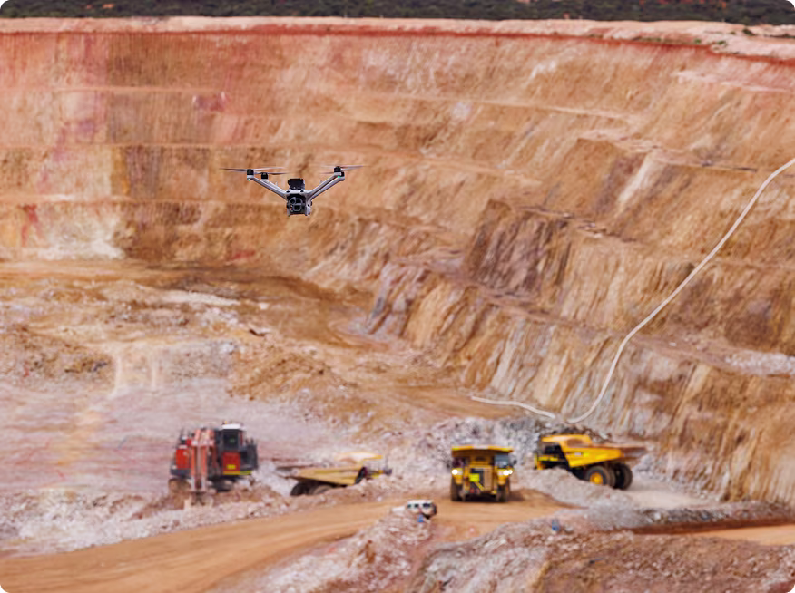
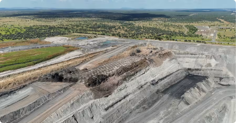
Pre- and post-blast surveys
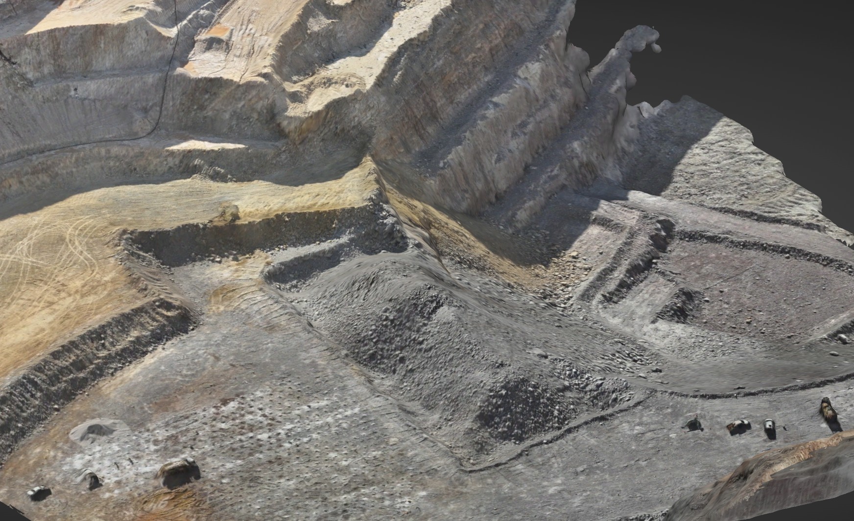
Drill and blast teams rely on accurate survey data to plan and assess each blast. xBot captures high-resolution imagery and survey data before and after blasts, giving teams fast, reliable information to review results and plan the next cycle. This supports better blast analysis and keeps drill and blast operations running on schedule.
360° panoramas
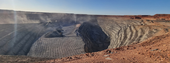
Understanding what’s happening across a large mine site can be challenging. xBot captures regular 360° panoramas that provide a clear visual overview of pits, infrastructure, and surrounding areas. These images help teams monitor site conditions, track changes over time, and maintain better situational awareness.
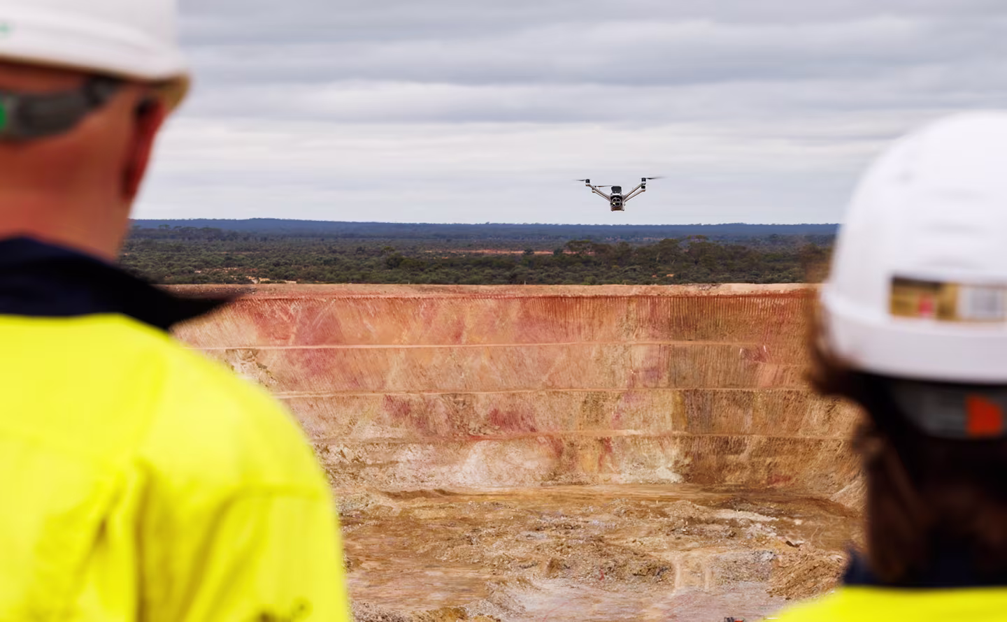
Pit wall inspections
Monitoring pit wall conditions is critical for maintaining safe operations. xBot captures detailed imagery of pit walls from safe distances, helping geotechnical teams review conditions and identify potential risks. Teams can inspect hazardous areas without sending personnel into dangerous locations.
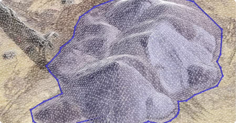
Stockpile surveys
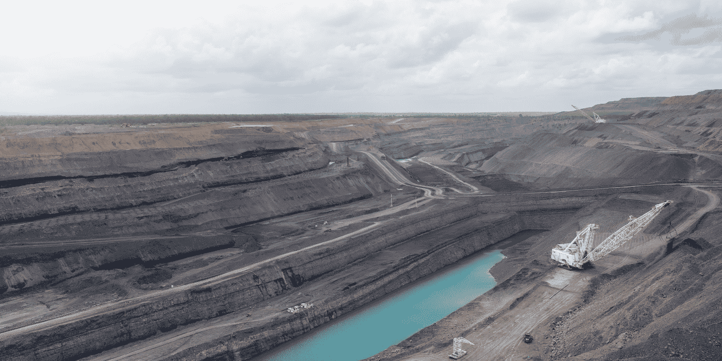
Accurate stockpile measurements are essential for production tracking and inventory management. xBot captures aerial imagery that can be used to generate precise stockpile volumes quickly and consistently. Operations teams get reliable data to support planning, reporting, and operational decisions.
On-demand missions
Mining operations often need information right away. xBot allows teams to request flights whenever they’re needed, whether that’s to inspect damage after a storm, check a remote area, or respond to an unexpected event. Drone usage can scale up or down as required without adding pressure to survey teams.


Live demo: See xBot in action
Want to see how the xBot system works? We'll show you exactly how other mines use it and give you some ideas for your own site. Choose from a live demo at our Perth operations center, or online.

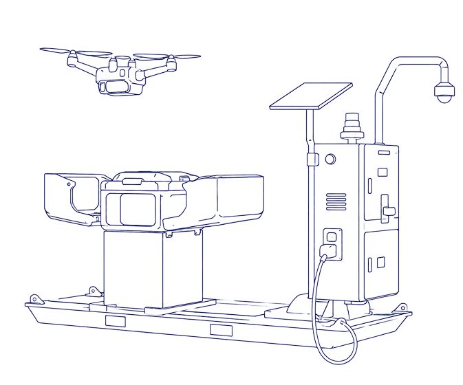
How it works
Get survey data and images whenever you need them. Schedule a mission, our remote pilots fly it for you, then your data is uploaded and ready to access in the cloud.
SkyLink
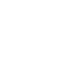
Anyone on site can schedule a flight in SkyLink.
Remote Ops Centre
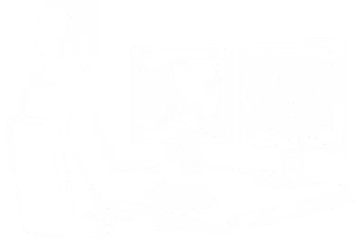
Our ROC team plans the mission and flies the xBot remotely.
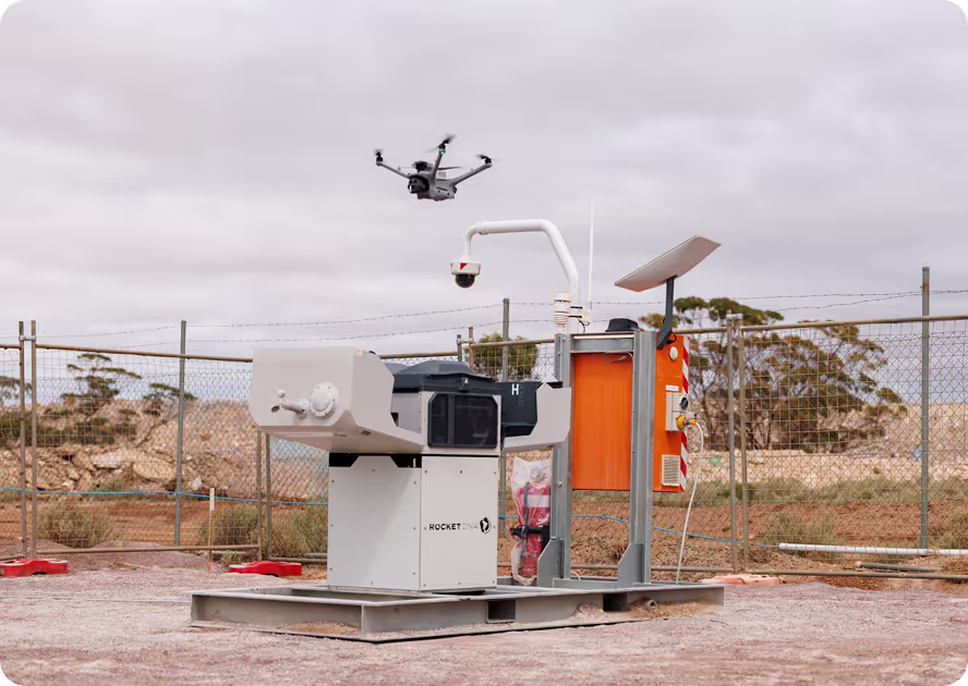
xBot Drone
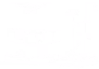
The xBot drone launches and our ROC pilot flies the mission.
SiteTube
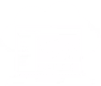
Your images & data are uploaded to Site Tube for your team to access.
Approved for Beyond Visual Line of Sight Operations
Operating drones at scale requires strict aviation compliance. Getting approvals to fly beyond visual line of sight (BVLOS) can take months or even years for most operators.
Our team manages aviation approvals and compliance for you. We are approved by Civil Aviation authorities to operate across Australia and Africa and have a large team of experienced pilots who remotely fly xBot missions beyond visual line of sight.
This allows sites to run safe, compliant drone operations without managing aviation approvals, licensing, or regulatory requirements internally.


Flexible commercial options
People are often surprised by how affordable this technology is now. We make it easy to get started with flexible options to suit your operational and budget requirements.
You can choose to purchase or lease the DIAB unit and operate it yourself. Or get us to handle everything, including remote operations, with a flexible pay per use consumption model.
Contact us to learn more.

Numbers at a glance
Downloads
Live demo: See xBot in action
Want to see how the xBot system works? We'll show you exactly how other mines use it and give you some ideas for your own site. Choose from a live demo at our Perth operations center, or online.
Frequently Asked Questions
Our remote operations team flies the missions for you. Customers use our SkyLink software to request flights, then a licensed pilot remotely operates the drone from one of our remote operations centres. Our team of pilots gives you drone coverage whenever you need it, even for last minute and weekend requests.
Yes. Your teams can request flights whenever current imagery or survey data is needed. Instead of waiting for crews to travel across site and manually capture imagery, flights can be scheduled remotely through our SkyLink software. In SkyLink you can also manage drone availability, daily & weekly schedules, and even multiple DIAB units across multiple sites.
Yes. RocketDNA is CASA-approved to remotely operate xBot systems beyond visual line of sight (BVLOS) across Australia. BVLOS approvals are critical for remotely operated drone systems because they allow missions to be flown safely without requiring pilots to remain physically near the drone. Our team manages all aviation approvals, compliance, and operational requirements needed to run these missions safely at scale.
xBot combines permanently deployed drone-in-a-box infrastructure, remote drone operations, and cloud-based software into one operational system. The drone stays on site inside a weatherproof docking unit where it charges automatically between missions. Teams schedule flights using SkyLink, our pilots remotely fly the mission, and the imagery and survey data are uploaded to SiteTube for instant access across site.
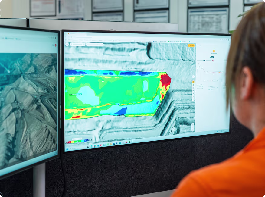
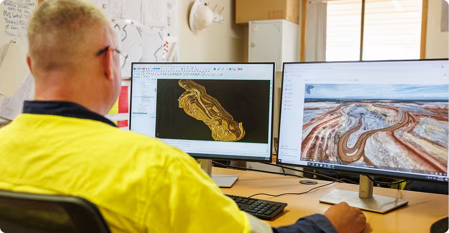
All imagery and survey data captured by the xBot is uploaded to SiteTube, our secure cloud platform. It puts all of your drone data in one place for easy access and collaboration. Anyone, on or off site, can access the data without needing to transfer files manually or rely on local network storage.
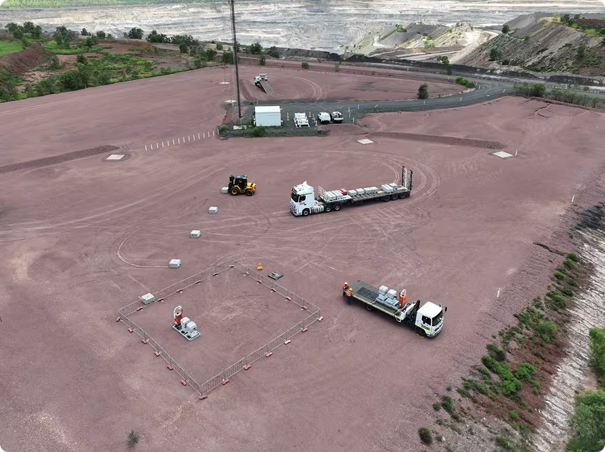
We manufacture the xBot as a self-contained, skid-mounted, drone-in-a-box unit. It's designed to deploy quickly, most sites just need a clear area with hardstand gravel and power nearby to connect to. We also offer solar and generator powered units. StarLink provides quick internet access without making things complicated for site IT teams. New sites are typically up and running within a few weeks of ordering a new unit.
The system is used across large variety open-pit mining operations where teams need regular access to current imagery and survey data. Most sites start with routine survey missions, then expand into use cases like blast surveys, pit wall inspections, stockpile monitoring, water level checks, tailings inspections, and on-demand operational flights. It’s also used in other industries for asset inspections, construction progress surveys, and security monitoring applications.

Customer case studies
Want to see the xBot in action?
Get in touch to request a live demo of the xBot system. Learn how it works and how other mines use it daily to improve their operations.