.svg)

Back
.svg)
No items found.
No items found.
TRUE
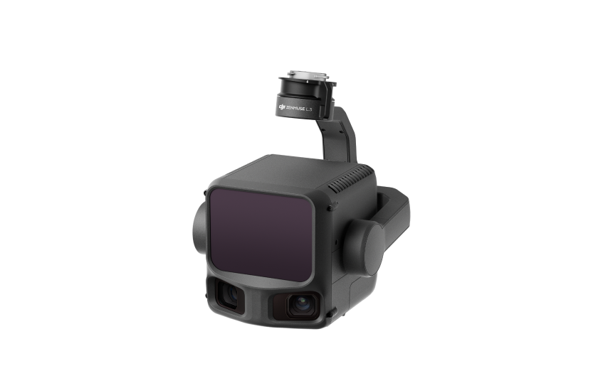
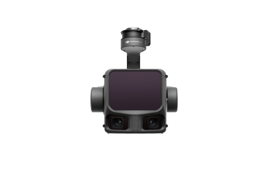
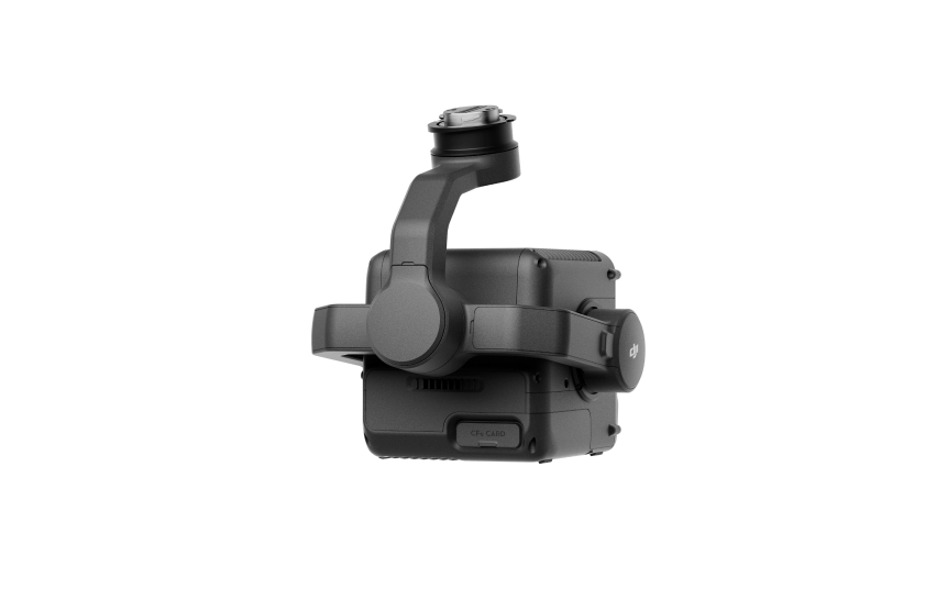
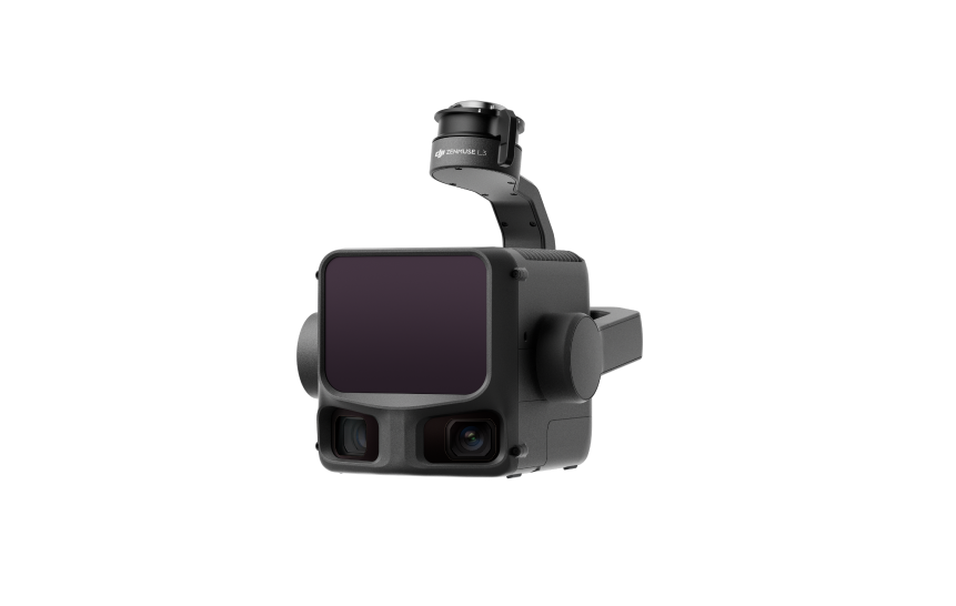
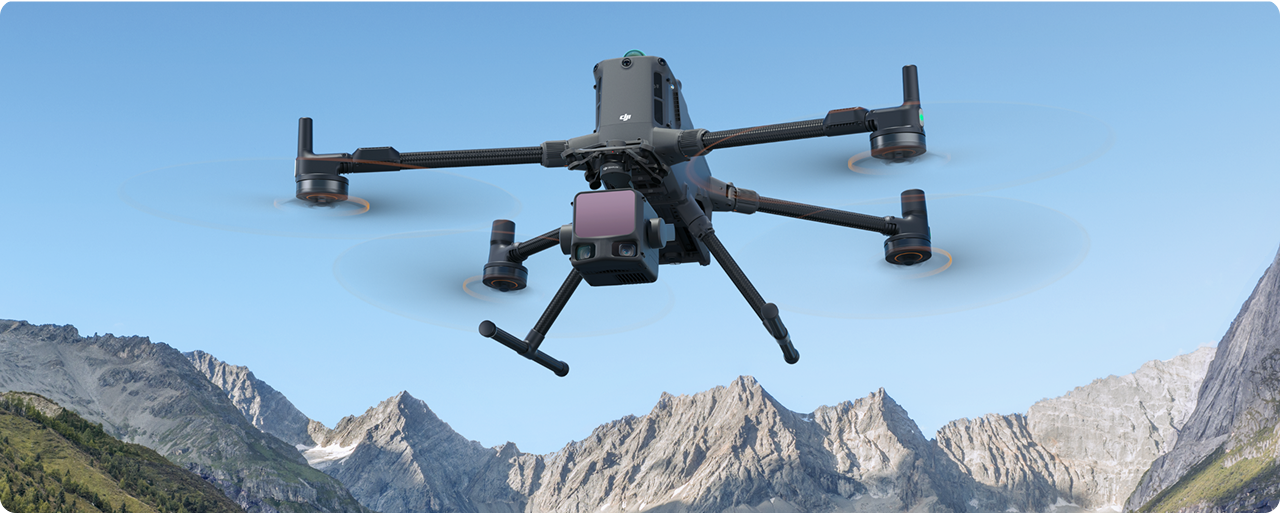
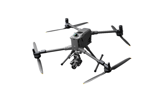
DJI Zenmuse L3
Long Range Lidar
Starting from
R257,690 excl VAT
R257,690 excl VAT
excl GST
R257,690 excl VAT
DJI's next-generation high-accuracy aerial LiDAR system features a long-range LiDAR capable of reaching up to 950m even on objects with just 10% reflectivity. Dual 100MP RGB mapping cameras and a high-precision POS system accelerate geospatial data acquisition, enabling daily coverage of up to 100 km². Zenmuse L3 seamlessly integrates with DJI's ecosystem to deliver an end-to-end mapping solution. From data acquisition and processing to application, this unified workflow is simpler to operate and easier to master than traditional multi-platform setups, helping users efficiently complete a wide range of mapping tasks.
Available Packages
Add-Ons
- Auto-activated
- DJI Zenmuse L3 with DJI Care Enterprise Plus

Key Features Include:
- 1535nm Long Range LiDAR
- Dual 100MP RGB Mapping Camera System
- High Accuracy
- High Penetration
- Up to 100 km2 coverage per Day
- End-To-End Solution

Hardware Specifications

Dock
Product Name
RocketDNA xBot (Mine-spec Version)
Total Weight
400kgs Incl Dock & Aircraft on robust galvanised steel skid
The actual product weight might vary due to differences in batch materials and external factors
Dimensions
400 x 2700 x 2400
The above data does not include the height of the wind speed gauge (145 mm) but includes the height of the mounting base brackets (55 mm).
Connectivity
Starlink, WiFi & Ethernet
Monitoring & Safety
Built-in CCTV, Weather Station & Fire Safety Systems
Communications
Industrial Electrical & Comms Panel
Product Name
DJI Dock 2
Total Weight
34 kg (without aircraft)
The actual product weight might vary due to differences in batch materials and external factors
Dimensions
Dock Cover Opened: 1228x583x412 mm (LxWxH)
Dock Cover Closed: 570x583x465 mm (LxWxH)
The above data does not include the height of the wind speed gauge (145 mm) but includes the height of the mounting base brackets (55 mm).
Input Voltage
100-240 V (AC), 50/60 Hzk 2
Input Power
Max 1000 W
Operating Temperature
-25° to 45° C (-13° to 113° F)
When the ambient temperature is below -20° C (-4° F), the dock is in standby status, and the aircraft cannot perform flight tasks.
Ingress Protection Rating
IP55
Max Operating Altitude
4000 m
Receiving Frequency of RTK Base Station Satellite
Simultaneously receive:
GPS: L1 C/A, L2
BeiDou2: B1l, B2l, B3l
BeiDou3: B1l, B3l
GLONASS: L1, L2
Galileo: E1, E5B
Product Name
DJI M3D or M3TD
Max Takeoff Weight
1610 g
DimensionsMax Wind Speed Resistance
During Operation: 12 m/s
During Takeoff/Landing: 8 m/s
Max Takeoff Altitude
4000 m
Max Flight Time
50 minutes
Measured in a controlled test environment. Specific test conditions are as follows: flying forward at a constant speed of 46.8 kph in a windless laboratory environment at 20 meters above sea level, in photo mode (without photo-taking operation during flight), with Obstacle Avoidance Action set to Off, and from 100% battery level until 0%. Results may vary depending on the environment, actual use, and firmware version.
Global Navigation Satellite System
GPS + Galileo + BeiDou + GLONASS (GLONASS is supported only when the RTK module is enabled.)
Hovering Accuracy Range (windless or breezy)
Vertical:
±0.1 m (with vision positioning)
±0.5 m (with GNSS positioning)
±0.1 m (with RTK positioning:
Horizontal:
±0.3 m (with vision positioning)
±0.5 m (with GNSS positioning)
±0.1 m (with RTK positioning)
Operating Temperature
-20° to 45° C (-4° to 113° F)
Receiving Frequency of RTK Base Station Satellite
Simultaneously receive:
GPS: L1 C/A, L2
BeiDou2: B1l, B2l, B3l
BeiDou3: B1l, B3l
GLONASS: L1, L2
Galileo: E1, E5B
Ingress Protection Rating
IP54
DJI Matrice 3D
DJI Matrice 3TD
Wide-angle Camera
4/3 CMOS
24mm Format Equivalent
20MP Effective Pixels
Mechanical Shutter
1/1.32-inch CMOS
24mm Format Equivalent
48MP Effective Pixels
No mechanical shutter
Tele Camera
1/2-inch CMOS
162mm Format Equivalent
12MP Effective Pixels
56x hybrid zoom
1/2-inch CMOS
162mm Format Equivalent
12MP Effective Pixels
56x hybrid zoom
Thermal Camera
N/A
40mm Format Equivalent
28x Digital Zoom
↳ Normal Mode
640x512@30fps
↳UHR Infrared Image Mode:
1280x1024@30fps(With the UHR Infrared Image function enabled, the aircraft automatically enables or disables UHR Infrared Image mode according to the ambient light brightness.)
Skid-Mounted Power System:
- Integrates with xBot® System
- Hybrid Battery & Diesel Generator Power System (240v)
- Remote Monitoring & Control
- 10kWh of Lithium-ion Battery Power
- 6kVa Diesel Generator + 100 litre fuel tank
- Built for high-temperature environments
- SolarSkid-input ready (max 2 skids)
- (Optional: ADS-B Receiver)
Skid mounted Solar System:
- 1.78kWp
- Galvanised Steel Skid Platform
- Built for high-temperature environments
- Adjustable from zero to 40 degrees
Hardware Specifications
- Product Name Zenmuse L3
- Point Cloud System Accuracy
- At 120 m flight altitude: Vertical accuracy: 3 cm (RMSE); Horizontal accuracy: 4 cm (RMSE).At 300 m flight altitude: Vertical accuracy: 5 cm (RMSE); Horizontal accuracy: 7.5 cm (RMSE).
- Point Cloud Thickness
- 1.2 cm @ 1σ (120 m nadir flight altitude);
- 2 cm @ 1σ (300 m nadir flight altitude).
- Weight1.60 kg (without single gimbal connector).
- Dimensions (L×W×H)
- 192 × 162 × 202 mm
- Supported Aircraft DJI Matrice 400 (requires the Zenmuse L3 single gimbal connector).
- Ingress Protection RatingIP54
- Operating Temperature
- -20°C to 50°C
- Lidar Laser Wavelength
- 1535 nm
Hardware Specifications
- Product Name
- Matrice 400
- Take-off Weight
- Without batteries: 5020 g
- With batteries: 9740 g
- Dimensions (L × W × H)
- Folded: 490 × 490 × 480 mm
- Unfolded: 980 × 760 × 480 mm
- Max Payload
- 6 kg
- Propeller Size
- 25 inches
- Max Ascent Speed
- 10 m/s
- Max Takeoff Altitude
- 7000 m
- Max Flight Time (No wind)
- 59 min
- Measured with the aircraft flying forward at 10 m/s in a windless environment at sea level, carrying only the H30T (total weight 10,670 g), from 100% to 0% battery.
- Data is for reference only; actual experience may vary depending on environment, usage, and firmware version.
- Max Flight Distance (No wind)
- 49 km
- Measured flying forward at a constant 17 m/s in a windless environment at sea level, without external payloads, from 100% to 0% battery.
- Results may vary by environment, usage, and firmware.
- Max Wind Speed Resistance
- 12 m/s (during take-off and landing)
- Compatible Battery
- TB100
- Operating Temperature
- −20° to 50° C (−4° to 122° F), without solar radiation
- Sensing Type
- Omnidirectional binocular vision system (surround view via full-colour fisheye sensors)
- Horizontal rotating LiDAR
- Upper LiDAR
- Downward 3D infrared range sensor
- Six-direction mm-wave radar
- FPV Camera Resolution
- 1080p
- Video Transmission System
- DJI O4 Enterprise Enhanced Video Transmission System
- DJI Products Compatible with M400
- Gimbal Cameras:
- Zenmuse H30
- Zenmuse H30T
- Zenmuse L2
- Zenmuse P1
- Accessories:
- Zenmuse S1 (drone spotlight)
- Zenmuse V1 (drone speaker)
- Manifold 3
- DJI RC Plus 2 sub2G SDR Module
- DJI Cellular Dongle 2
- RTK Station:
- D-RTK 3 Multifunctional Station
- D-RTK 2 Mobile Station
- Ecosystem Accessories:
- DJI X-Port
- DJI E-Port V2 Development Kit
- DJI E-Port V2 Coaxial Cable Kit
- DJI SKYPORT V3 Adapter Set
- DJI SKYPORT V3 Coaxial Cable Kit
- Gimbal Cameras:
Product Reviews
Frequently Asked Questions
No items found.
%201%20(1).webp)
Talk to an expert
Thank you! Your submission has been received.
Oops! Something went wrong while submitting the form.