.svg)

.svg)
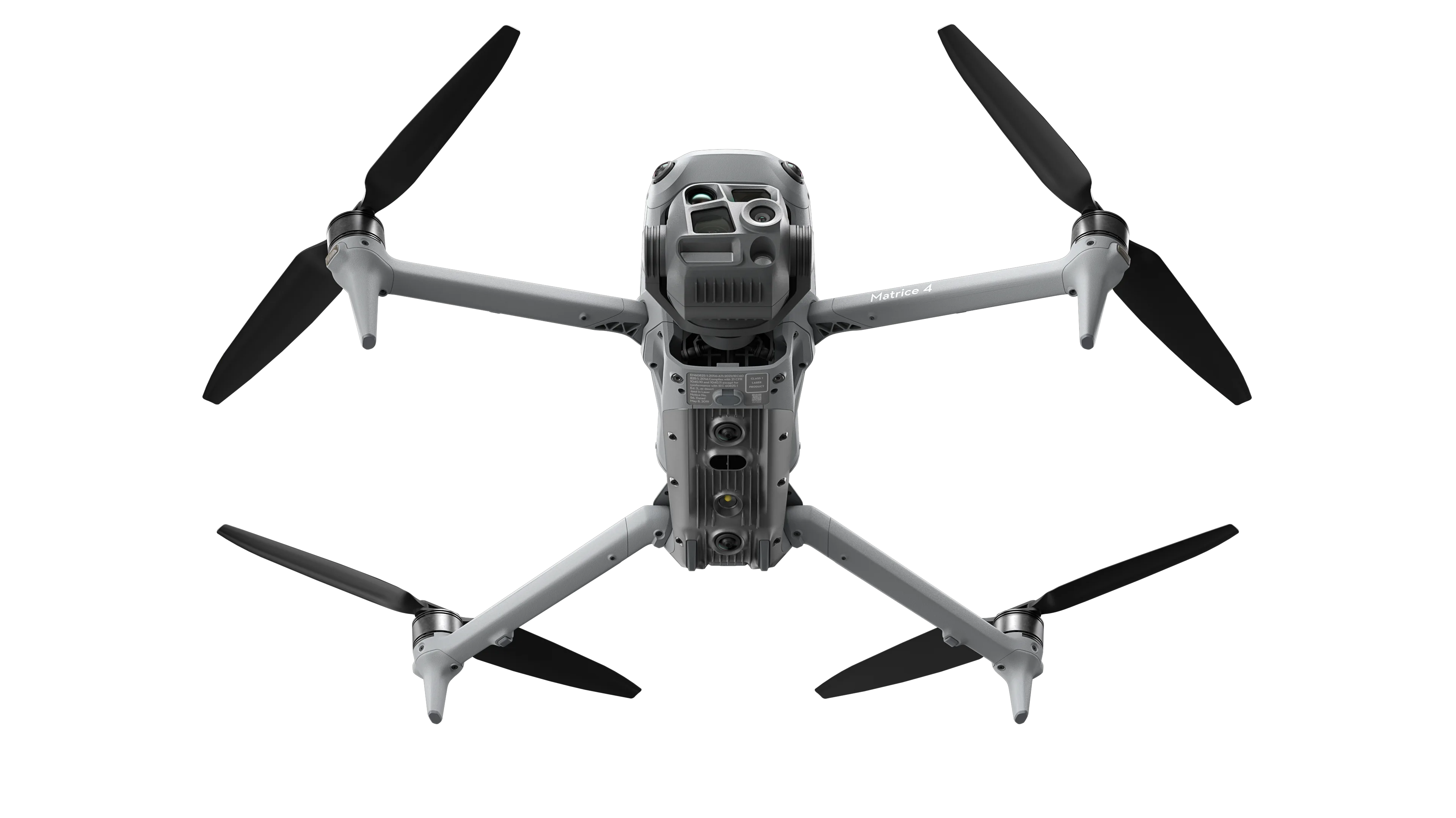
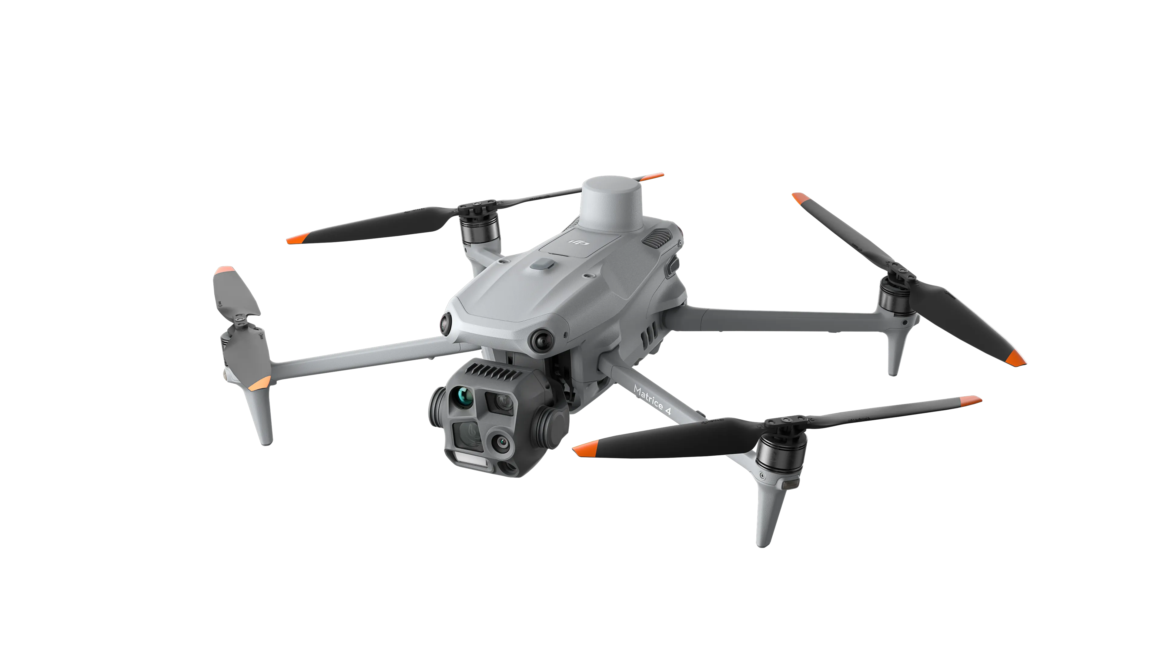
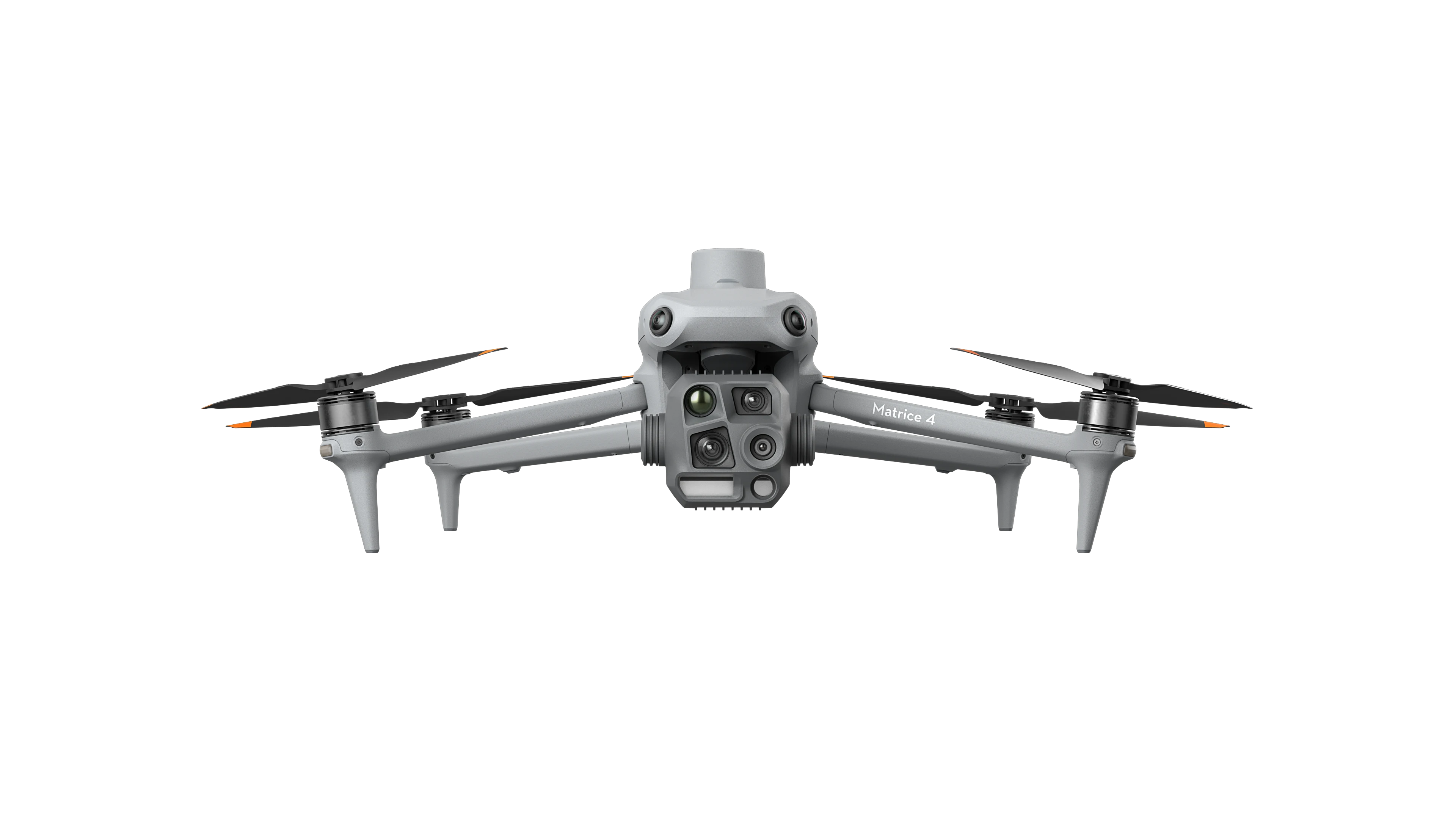
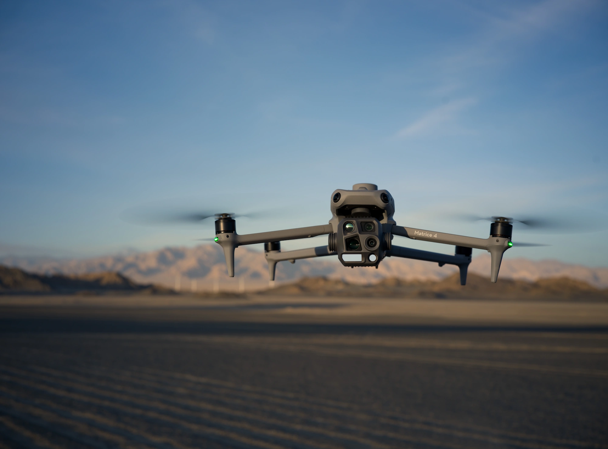
DJI Matrice 4T
Intelligent Multi Sensor Drone
Starting from
The DJI M4T drone is part of the M4 series of intelligent, multi sensor drones for enterprise applications. The Matrice 4T is designed for a wide range of industries, including asset inspection and monitoring, emergency response, public safety, and forestry. This drone is equipped with advanced features, such as built-in AI modelling to detect humans, vehicles and cars during operation, as well as a laser range finder that supports precise measurement, including distance range detection and target coordinate measurement, pin point, line drawing and area calculation.
Available Packages
- DJIM4TPLUS
- DJI Matrice 4T Including DJI Care Enterprise Plus Auto-Activated
Add-Ons
- Auto-activated
- DJI Zenmuse L3 with DJI Care Enterprise Plus
.webp)
Key Features Include:
- 3-directional ortho capture and 5-directional oblique capture
- Built in RTK module
- 49-minute flight time.
- Minimum capture interval of 0.5s
- Real time AI detection of people and vehicles
- Laser range finder for real-time precision measurement
- Excels in low-light environments
- Infrared Thermal Camera
Flight operations are now safer, more reliable, and powered by AI, with significantly enhanced sensing capabilities. The accessories for the Matrice 4 series have also been significantly upgraded.
The Matrice 4Tis significantly upgraded. The Matrice 4T is designed for a wide range of industries, including asset monitoring and management, emergency response, public safety, and forestry. The M4T comes with a built-in RTK module and has49 minutes flight time.
The M4T has 6sensors in one compact aircraft. including wide camera, medium tele camera, tele camera, laser ranger finder, Infrared Thermal Camera and NIR AuxiliaryLight. The 112 maximum zoom can see a car plate from 250m away. UHR Infrared Images provide superior thermal image quality, while full-colour view and black-and-white view improve the live view quality and clarity in low light environments. Foreground stabilization and electronic dehazing make inspection images (pipe and electricity lines, for example) more stable and clearer. Distortion Correction 2.0 provides high-precision in-camera distortion correction with residual distortion less than 2 pixels.
The built-in AI model can detect humans, vehicles and cars during drone operation, with AI computing capability open for 3rd party industry application platform development.Laser ranger finder supports precise measurement, including distance, range detection and target coordinate measurement, pin point, line drawing and area calculation.
.webp)
Hardware Specifications

Hardware Specifications
- Product Name Zenmuse L3
- Point Cloud System Accuracy
- At 120 m flight altitude: Vertical accuracy: 3 cm (RMSE); Horizontal accuracy: 4 cm (RMSE).At 300 m flight altitude: Vertical accuracy: 5 cm (RMSE); Horizontal accuracy: 7.5 cm (RMSE).
- Point Cloud Thickness
- 1.2 cm @ 1σ (120 m nadir flight altitude);
- 2 cm @ 1σ (300 m nadir flight altitude).
- Weight1.60 kg (without single gimbal connector).
- Dimensions (L×W×H)
- 192 × 162 × 202 mm
- Supported Aircraft DJI Matrice 400 (requires the Zenmuse L3 single gimbal connector).
- Ingress Protection RatingIP54
- Operating Temperature
- -20°C to 50°C
- Lidar Laser Wavelength
- 1535 nm
Hardware Specifications
- Product Name
- Matrice 400
- Take-off Weight
- Without batteries: 5020 g
- With batteries: 9740 g
- Dimensions (L × W × H)
- Folded: 490 × 490 × 480 mm
- Unfolded: 980 × 760 × 480 mm
- Max Payload
- 6 kg
- Propeller Size
- 25 inches
- Max Ascent Speed
- 10 m/s
- Max Takeoff Altitude
- 7000 m
- Max Flight Time (No wind)
- 59 min
- Measured with the aircraft flying forward at 10 m/s in a windless environment at sea level, carrying only the H30T (total weight 10,670 g), from 100% to 0% battery.
- Data is for reference only; actual experience may vary depending on environment, usage, and firmware version.
- Max Flight Distance (No wind)
- 49 km
- Measured flying forward at a constant 17 m/s in a windless environment at sea level, without external payloads, from 100% to 0% battery.
- Results may vary by environment, usage, and firmware.
- Max Wind Speed Resistance
- 12 m/s (during take-off and landing)
- Compatible Battery
- TB100
- Operating Temperature
- −20° to 50° C (−4° to 122° F), without solar radiation
- Sensing Type
- Omnidirectional binocular vision system (surround view via full-colour fisheye sensors)
- Horizontal rotating LiDAR
- Upper LiDAR
- Downward 3D infrared range sensor
- Six-direction mm-wave radar
- FPV Camera Resolution
- 1080p
- Video Transmission System
- DJI O4 Enterprise Enhanced Video Transmission System
- DJI Products Compatible with M400
- Gimbal Cameras:
- Zenmuse H30
- Zenmuse H30T
- Zenmuse L2
- Zenmuse P1
- Accessories:
- Zenmuse S1 (drone spotlight)
- Zenmuse V1 (drone speaker)
- Manifold 3
- DJI RC Plus 2 sub2G SDR Module
- DJI Cellular Dongle 2
- RTK Station:
- D-RTK 3 Multifunctional Station
- D-RTK 2 Mobile Station
- Ecosystem Accessories:
- DJI X-Port
- DJI E-Port V2 Development Kit
- DJI E-Port V2 Coaxial Cable Kit
- DJI SKYPORT V3 Adapter Set
- DJI SKYPORT V3 Coaxial Cable Kit
- Gimbal Cameras:
Product Reviews
Related Accessories
Frequently Asked Questions
%201%20(1).webp)