


All of your drone data in one place
SiteTube gives everyone on site instant access to current drone imagery & data. Less file sharing hassles, easier collaboration between teams.
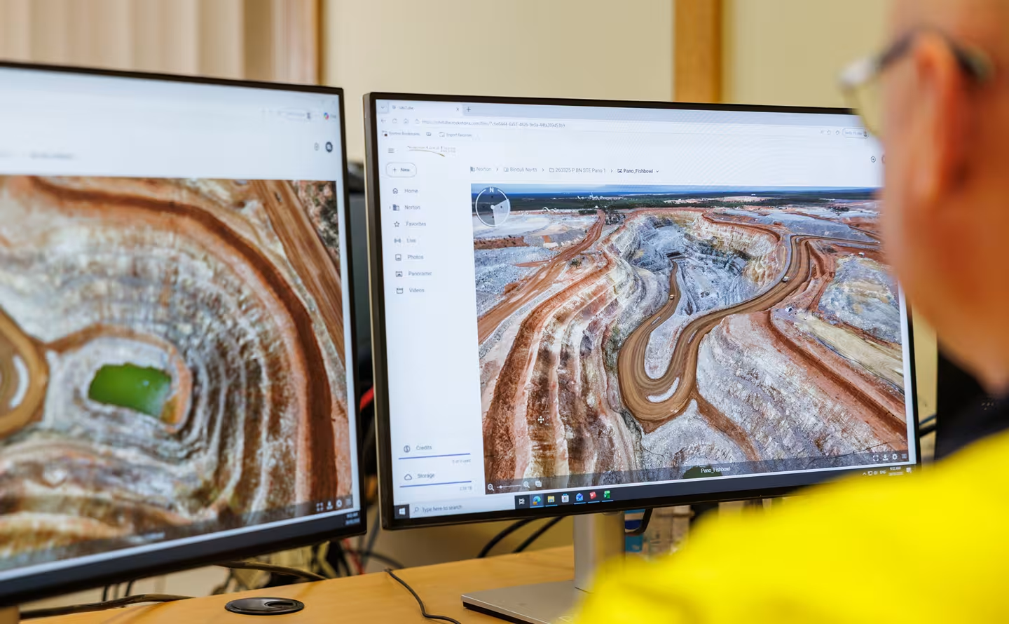
Drone surveys generate valuable data, but create a lot of work
Manual file uploads, processing, and file management can slow teams down. SiteTube automatically uploads and organises your drone data in the cloud. With an xBot on site you simply request a flight, we fly it remotely, then your processed data is ready for you in SiteTube.

Secure cloud access
All of your imagery and data stored securely in one place on Australian SSO servers

Automatic file processing
After a flight, the data is automatically uploaded and processed into the format you need

Easy file sharing
SiteTube makes it easy to share survey files with anyone who needs them, on or off-site

All survey file types
SiteTube supports all major survey file types and gives you unlimited cloud storage
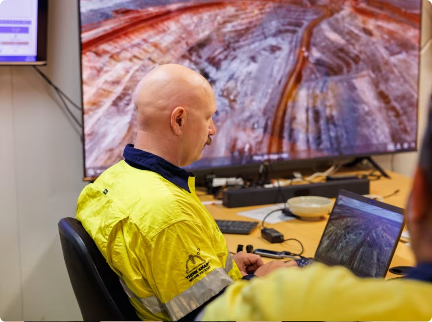
Get current drone imagery within 15 minutes
When you need to know what’s happening on site right now, getting a drone in the air takes time. On large mines, just driving out there to inspect conditions can slow things down further. With an xBot, you can check all that information in SiteTube before you head out and focus your attention where it’s actually needed.
The autonomous drone system removes the need for manual mission planning, drone setup, drive time, downloading files and data processing. For surveyors, that can turn a 2-hour job into a 15-minute one with the same quality output.
.avif)
Store all your drone data in one place
When different teams or external contractors need access, file sharing can be cumbersome and slow. With SiteTube, your data is stored securely in the cloud so it can be accessed anywhere by anyone on site. No folder permissions, running out of network drive space, or files on USB sticks. It’s a single source of truth for every flight, capture, and dataset.
.avif)
Automate data processing to fit your workflows
Raw images and survey data often require conversion and processing before they’re useful. This takes up surveyor time, slowing down operational decisions.
SiteTube automatically processes and displays imagery and survey data in a format that integrates with your existing downstream workflows, ready to use. So your teams get actionable insights immediately.
.avif)
Easy to scale as your operations grow
As operations grow and more drones are used across multiple sites, keeping data organised and accessible becomes messy and complicated.
SiteTube makes it easy to store your data from multiple drones and locations in one place. You can manage large volumes of imagery and survey information while giving everyone access to it, no matter where they are located.
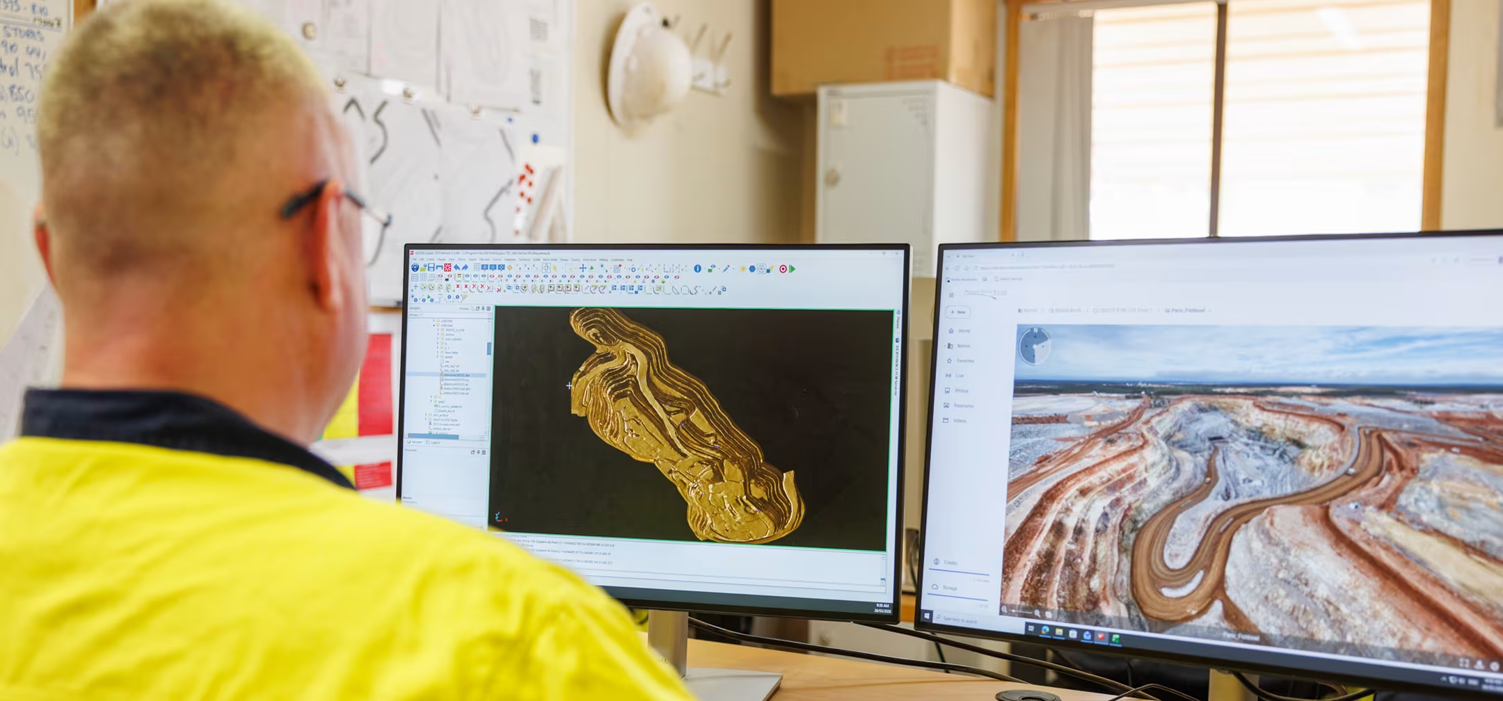








Easily manage & share your drone data
SiteTube is a shared cloud drive, built specifically for drone data. It gives you one central system where every capture is stored, ready for your teams to use. For multi-site operations, SiteTube consolidates information from all locations, so your teams have a single source of truth for images and data.
Easily add users and share across large teams
SiteTube gives your teams a better way to collaborate and access the data they need for meetings and operational decisions. Add new users in a couple of clicks or adjust sharing access for sensitive files. Teams can access what they need from anywhere, while you control permissions across departments and projects.

Compare historical images side-by-side
Check how a pit has progressed, review post-blast conditions, or confirm changes to haul roads and stockpiles. Every capture is stored in one place, so you’ve got a consistent visual record to refer back to and compare then to now.
.avif)
Visualise data geographically
With map view, you can see exactly where each piece of data was captured. Search by geographic location to see the complete range of data available in that area.
.avif)
Secure cloud-based access
Drone data is stored off-site in a secure cloud environment, not on your internal network. No local servers, no manual file handling, and no added load on site IT systems. Locally hosted on Australian SSO cloud servers, with role based access control, your data is secure and you have full control over who can access it.
.avif)
Supports all major survey file types
From raw images and video through to orthomosaics, point clouds, and 3D models. SiteTube supports the file types survey, planning, and geotech teams already use, so there’s no need to convert or move data between systems. And with unlimited cloud data storage, there’s no need to manage local drive space or archive old datasets.
.avif)
Know when your data will be ready
Uploads begin automatically the moment the drone lands, so you don’t have to wait for files to be manually transferred or processed. A live progress indicator tells you exactly when your images and files will be ready. It’s easy to schedule daily and weekly flights so you can rely on reliable information being available whenever you need it.
.avif)
See SiteTube in action
Centralise your drone data, automate processing, and get instant access to reliable imagery and insights.

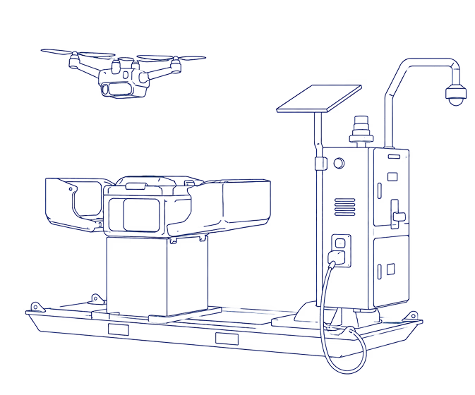
Here’s how SiteTube fits in to the xBot system
SkyLink

Anyone on site can schedule a flight in SkyLink.


Remote Ops Centre

Our ROC team plans the mission and flies the xBot remotely.
xBot Drone
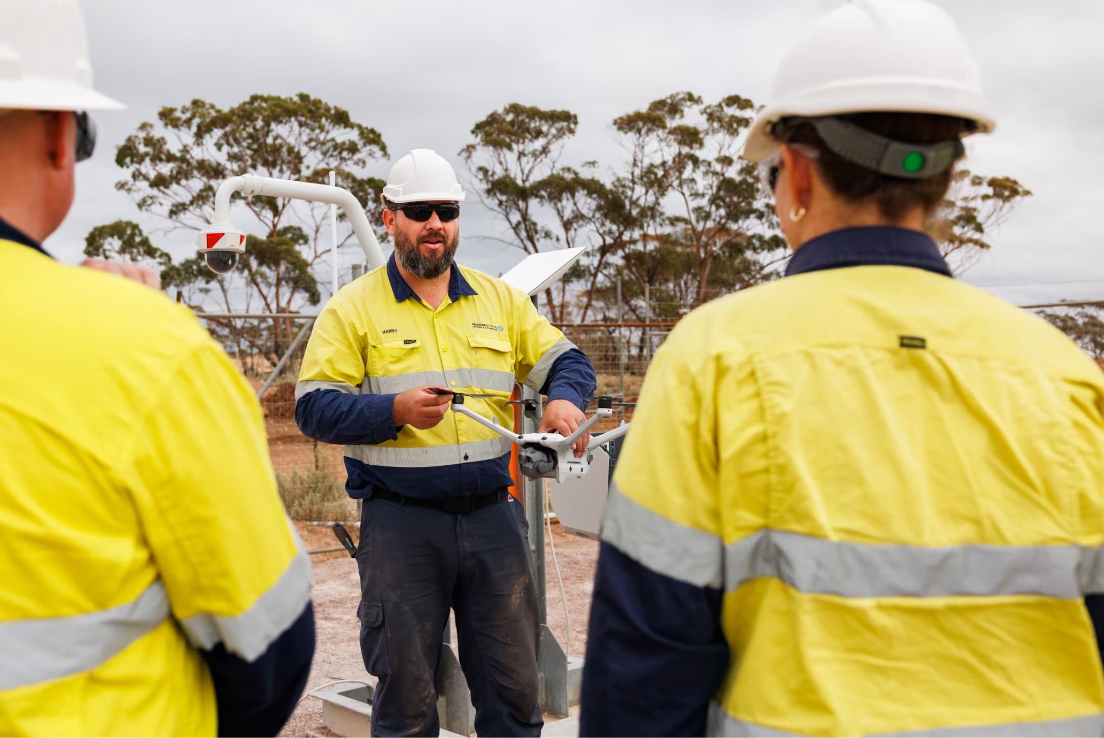
The xBot drone launches and our ROC pilot flies the mission.
SiteTube
Your images & data are uploaded to Site Tube for your team to access.
Approved for Beyond Visual Line of Sight Operations
Operating drones at scale requires strict aviation compliance. Getting approvals to fly beyond visual line of sight (BVLOS) can take months or even years for most operators.
Our team manages aviation approvals and compliance for you. We are approved by Civil Aviation authorities to operate across Australia and Africa and have a large team of experienced pilots who remotely fly xBot missions beyond visual line of sight.
This allows sites to run safe, compliant drone operations without managing aviation approvals, licensing, or regulatory requirements internally.




.avif)
Flexible commercial options
People are often surprised by how affordable this technology is now. We make it easy to get started with flexible options to suit your operational and budget requirements.
You can choose to purchase or lease the DIAB unit and operate it yourself. Or get us to handle everything, including remote operations, with a flexible pay per use consumption model.

Numbers at a glance
See SiteTube in action
Centralise your drone data, automate processing, and get instant access to reliable imagery and insights.
Frequently Asked Questions
Yes. SiteTube is designed so site teams, office teams, consultants, and approved contractors can work from the same record without passing files around manually. Access can be managed by workspace or project, so people only see the data they are meant to see.
Storage is set up around your workspace and service plan. SiteTube is built for high-volume operational data such as drone imagery, video, survey files, panoramas, and processed outputs, and storage can be scaled to match single-site or multi-site programs.
It is not limited to drone photos. SiteTube can store and organise a wider set of operational files, including images, videos, 360 panoramas, GIS and survey files, point clouds, spreadsheets, PDFs, supporting text and telemetry files, and zip files. Some formats can be viewed directly in SiteTube; others are stored for download, processing, or integration with your existing workflows.
Retention depends on your agreement, workspace settings, and storage allowance. For most customers, SiteTube is used as an ongoing operational record so teams can revisit historical site conditions, compare change over time, and keep project data accessible while the service remains active.
SiteTube is hosted on secure cloud infrastructure and uses authenticated access, role-based controls, private storage, and encrypted cloud services. RocketDNA also conducts regular penetration testing to help identify and address security risks. Hosting region, data residency, and customer-specific security requirements can be confirmed during onboarding or contract review.
Yes. You can manually download data from SiteTube, and RocketDNA is launching the SiteDrive API to provide controlled API access to your SiteTube data. This will help customers connect SiteTube with existing GIS, reporting, storage, and operational systems.
Yes. SiteTube is intended to fit into existing data workflows, including downloads, API-based workflows, GIS platform delivery, and custom integrations. RocketDNA’s public site already positions SiteTube alongside GIS, API webhook, ArcGIS, Civil 3D, Leapfrog, AWS S3, Azure, DroneDeploy, and Strayos-style workflows.
Images and video are available immediately as soon as they are uploaded or synced into SiteTube. Post-processing time depends on the workflow: some outputs can take seconds, while larger photogrammetry tasks may take hours depending on dataset size and processing requirements.
No. SiteTube is there to remove friction from data access, sharing, and repeatable workflows. Your survey, engineering, environmental, and operations teams can keep using their specialist tools while SiteTube gives them a central place to find the latest captured data.
Yes. SiteTube is well suited to multi-department access across survey, geology, mine planning, environment, geotechnical, construction, and operations teams. Each team can access the data they need without relying on ad-hoc file sharing.
Your plan can be reviewed as usage grows. If a site moves from occasional uploads to daily capture, multi-site operations, or high-volume video and survey storage, RocketDNA can adjust the commercial setup to match the operating model.

Customer case studies

See SiteTube in action
Centralise your drone data, automate processing, and get instant access to reliable imagery and insights.

To get the latest RocketDNA product related news, subscribe to our Email Alerts.
The information that you provide above will be processed according to our Privacy Policy.