Project Overview
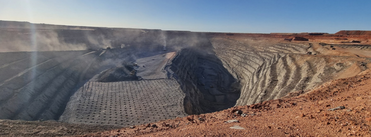
Gruyere, a large open-pit gold mine in Western Australia, faced a common, frustrating survey problem. Their busy survey team worked hard to keep up with growing demand for drone surveys across the site. More departments were requesting drone surveys, aerial imagery, and 3D data more frequently, often at short notice.
At the end of each month, the problem got worse. Management needed stockpile data, other teams needed extra pit surveys for planning and conformance.
The team at Gruyere needed a way to handle these spikes in demand without adding to surveyor workloads while also giving everyone on site better, more frequent access to the survey data they needed.
Here’s how they did it.
The problem: increasing survey demand
Like many mines, the survey team flew drones manually themselves and handled most of the site’s data capture.
The surveyors felt extra pressure at the end of every month when survey demand spiked for volume reporting and at the same time, ad hoc survey requests didn’t slow down, they just piled up.
Other departments wanted imagery more often. If they needed to check pit conformance more frequently, or give the geotechs updated wall models several times a week, a surveyor had to plan and fly those missions, adding to their already heavy workload.
This is a common problem at most mines. Surveyors across the industry tell us they’re overloaded and even burnt out. Demand for drone surveys keeps growing but you can’t simply throw more people at the work. Skilled surveyors are in demand, creating a skills shortage. So, most survey teams run lean, and may have coverage gaps from time to time when there are vacant positions or people on leave.
.png)
Our recommendation: automate routine tasks to ease surveyor pressure
Gruyere’s team looked for ways to take pressure off their survey team. They reached out to us to find out if a drone-in-the-box system could help them increase drone survey capacity without putting more pressure on the surveyors during peak periods.
We recommended they use a single xBot autonomous drone unit to start handling some of the routine, repeatable survey tasks. Offloading frequent jobs like pit and ROM surveys would give the survey team space to focus on more specialist work, and give them more capacity at EOM.
From their perspective, an autonomous drone system made sense because it could operate every day, handle routine missions consistently, and ramp up at the end of month.
This would also address the increased requests for more drone surveys from other teams. More frequent survey data would help everyone across the mine do their jobs better, and more safely.
Mike Hobbs, a Grade 1 Authorised Surveyor at RocketDNA with extensive experience in open-pit mining says: “When you do more frequent drone flights, you can deliver more 3D models of the pit. The more visibility you have over the pit, the more often you can check conformance against design. It's a twofold win: the surveyors don't have to do it, and you can do it a lot more frequently.”
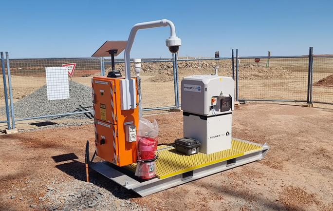
Fast setup: trialling the xBot system
The team at Gruyere decided to go ahead with a trial of the autonomous drone system and our team got started setting it up. Their goal was to keep the project simple, without heavy IT involvement or complex siteworks.
One of our senior surveyors assessed their setup on site. He reviewed coverage, planned flight areas, and examined their expected workloads to determine what was actually required. Because we already had CASA approval to operate drones beyond visual line of sight in this region, we could handle all of the regulatory work and take on the aviation risk for them. For new sites doing this themselves, the approval process can take 1-2 years.
The site only needed basic site works: a clear hard stand area and power. We delivered the xBot system on a self contained skid and connected it up to their power.
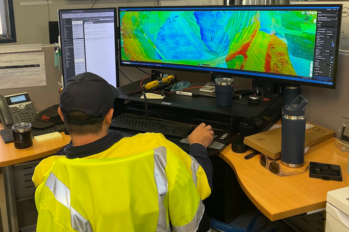
Most sites are concerned that they will need to get IT involved, making it a longer and more complex project. With its own Starlink connection included, our xBot system doesn’t need to connect to the mine’s network. The drone survey data is sent directly to our SiteTube platform, securely hosted on Australian servers, and anyone on site can be granted permission to access the data from their web browser
Less than 30 days after Gruyere gave us the go-ahead, they were operational and ready to use the new system.
Starting with core survey tasks then finding new applications
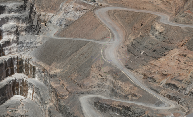
Gruyere’s surveyors immediately automated some of their routine survey and imagery missions like pit and ROM surveys. They could schedule these weekly, monthly, or more frequently and then get data sent straight to their inbox once the flight was completed.
Once this was working smoothly they kept finding new ways to use the xBot system. As their use cases expanded, they scheduled drone flights multiple times per week, adding additional flights when demand spiked.
Now they automate dozens of drone survey tasks, including:
- EOM surveys
- Twice-daily pit imagery
- Return to work imagery for shift changes
- Pit wall mapping for geotechnical monitoring
- Mill ball surveys
- Regular waste dump surveys
- Blast videos
- Post-blast surveys
- And monthly updates to site-wide imagery
The autonomous drone gives them consistent, predictable coverage and the ability to increase frequency when needed without overloading the surveyors even more.
.png)
Results: more frequent surveys, easier access to data
Now, the survey team can fly drone missions more regularly while having peace of mind that extra requests and busy periods won’t overwhelm them. With the drone-in-a-box on site ready to go, they can ramp up at end-of-month without adding extra pressure to the survey team.
Surveyors are now able to focus more on specialist work such as LiDAR, complex tasks, and non-standard missions, rather than spend valuable time on simple, repetitive flights.
Other departments on the mine appreciate having access to more frequent drone images and models when they need them. And with SiteTube, anyone can access the data from anywhere on the mine. Even offsite between swings, or at head office.
Operations teams can schedule daily panoramic images before shift changes so crews can review their work areas during return-to-work meetings. Geotechnical engineers get updated wall models multiple times per week, and can request new imagery daily when needed.
If there's a weather event with heavy rain, the drone can be used to inspect roads, culverts, and drainage channels instead of sending vehicles across wet ground. Previously, this would have been an extra request for the survey team who would have had to fit it in on top of core operational work. Now it can be requested on demand, and flown automatically.
“The overall feedback from site is that they’re all extremely happy with it. Not just the surveyors, all departments,” says Mike.
Changing how the site operates
What started as a way to manage spikes in survey demand has become an integral part of how the site operates. With the xBot drone system in place, Guyere has increased how often drone data is captured, made it easier for everyone to access, and relieved surveyor pressure during peak periods. Surveyors can now focus on specialist work, while routine flights run in the background.
As demand for drone survey data continues to grow across all mining operations, a system that scales with demand becomes less of a nice-to-have and more of a practical requirement.
Location

Contact RocketDNA Today
Interested in finding out more about how our drone data solutions can assist you with your data need?
Complete the contact form to get started and find out more.